
From survey points to a CAD drawing, in your browser
Import the points from your total station or GPS, or an AutoCAD drawing with contour lines or a TIN, and TopoCurvas builds the triangulation, contours, profiles and earthwork volumes. Export DXF, drawing sheets and a PDF report. Free, nothing to install, no account.
Developed by 
Features
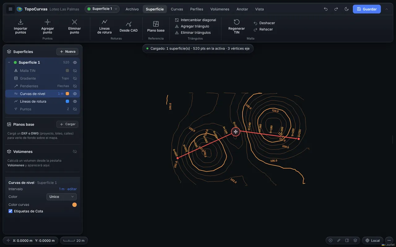
Contour lines
TIN triangulation, breaklines, index contours and elevation labels.
Learn more →Surfaces from CAD
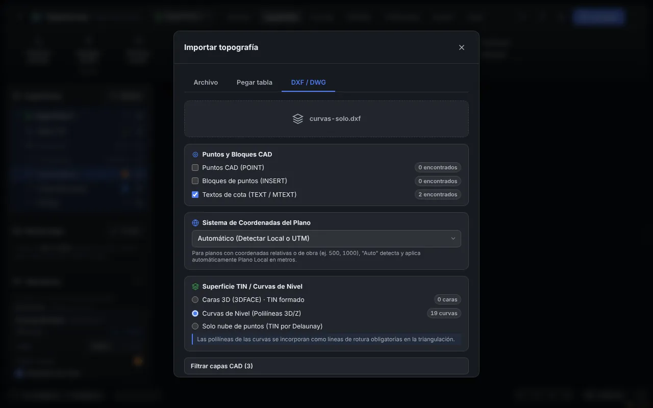
Import contour lines or a TIN from AutoCAD (DXF and DWG) and use them to generate contours and calculate volumes.
Learn more →Profiles and cross sections
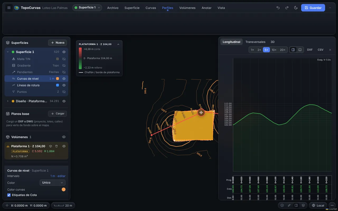
Longitudinal profile with data band and cross sections along an alignment.
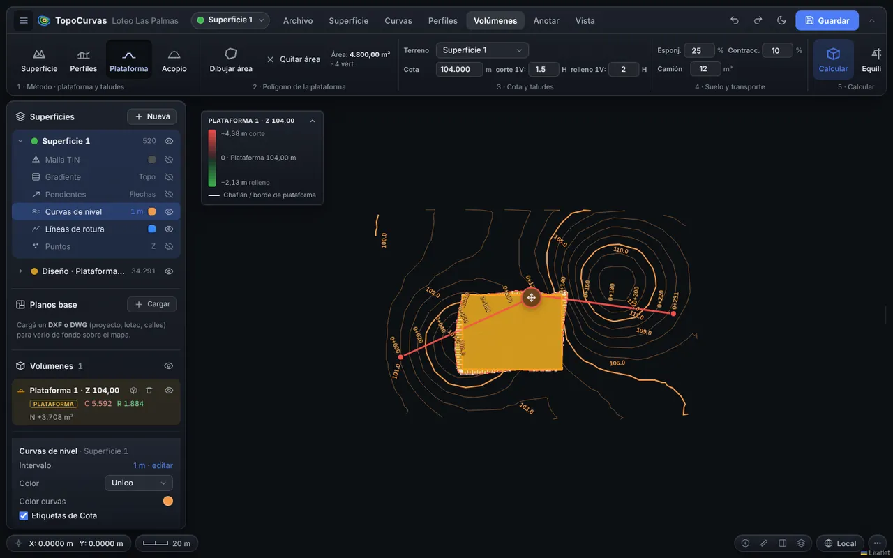
Learn more →Cut and fill volumes
Surfaces, profiles, pads with slopes and stockpiles, with a PDF report.
Learn more →DXF and sheets
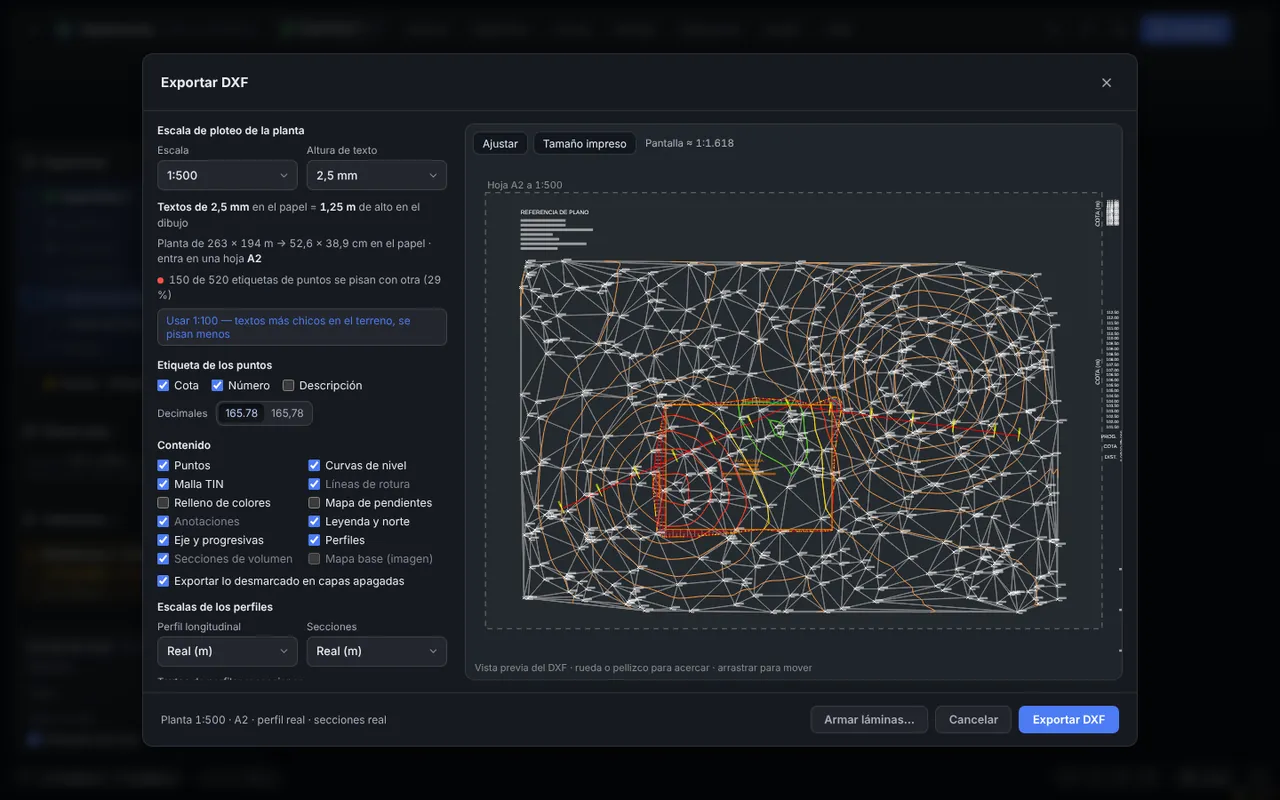
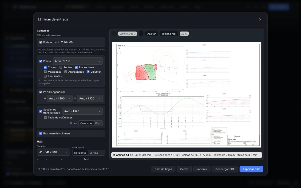
Organized layers, plot scale, preview, A0–A4 sheets and PDF.
Learn more →Slopes and 3D view
Slope map with runoff arrows and a 3D terrain model.
Works as an app
Install it on your PC, tablet or phone and use it offline too.
How it works
- Import your points or CAD drawingLoad a TXT, CSV or XYZ file with ID, X, Y, Z and description, or a DXF or DWG with contour lines or a 3D-face TIN. TopoCurvas detects the format and lets you pick the columns or layers.
- Generate and analyzeContours, profiles, sections and volumes are computed instantly on an editable TIN mesh.
- DeliverExport a DXF with organized layers, build drawing sheets with a title block and download the PDF report.
Who it is for
Surveyors
Turn your field book into a drawing with contour lines.
Civil and road engineers
Profiles, sections and earthworks for roads, subdivisions and sites.
Architects and planners
You receive a table of points and need a CAD base to design on.
Contractors and developers
Cut and fill quantities and earthmoving control.
Your data never leaves your device
All calculations run in your browser: your points and projects are never uploaded to a server. Save the project as a file and pick it up whenever you like.
Inside the tool
Developed by Structec
Structec is a Paraguayan structural engineering and geospatial solutions firm. We built TopoCurvas from our daily work with surveys, drones and LiDAR, and we offer it so more professionals can go from a table of points to a drawing.
- Drone and LiDAR surveys
- 3D models and Scan to BIM
- Structural calculation and review
- Topographic drawings and contour lines
- Courses to learn how to use TopoCurvas
- Custom development and adaptations
Want to get the most out of TopoCurvas? We teach courses and also build custom tools for your company.
Structec Maps: cadastre and cartography of Paraguay, free and no sign-up.
FAQ
Is TopoCurvas free?
Yes. It runs directly in your browser, with no sign-up and nothing to install.
Which point files does it accept?
TXT, CSV and XYZ text files with X, Y and elevation, separated by commas, semicolons, tabs or spaces. It also works in a local plane, without georeferencing.
Can I import contour lines or a TIN from AutoCAD?
Yes. Import a DXF or DWG: the contour polylines (with their elevation) or the 3D faces of a TIN become the working surface. With it you generate new contours, profiles and sections, and calculate cut and fill volumes.
Which coordinate systems are supported?
UTM and geographic coordinates, any EPSG code, and a local plane without georeferencing.
Can I open the drawings in AutoCAD?
Yes. The DXF comes with organized layers named in an ISO 13567 style and text sized for the plot scale you chose. It opens in AutoCAD, BricsCAD, LibreCAD and any program that reads DXF.
Does it work offline?
Yes. You can install it as an app and work without a connection. The satellite or street base map does need internet.
Who develops TopoCurvas?
Structec, a Paraguayan structural engineering and geospatial solutions firm: drone and LiDAR surveys, 3D models, Scan to BIM and structural review.
Try it with your own points
It runs in your browser: no account, nothing to install.
Open the free app