
Longitudinal profile and cross sections
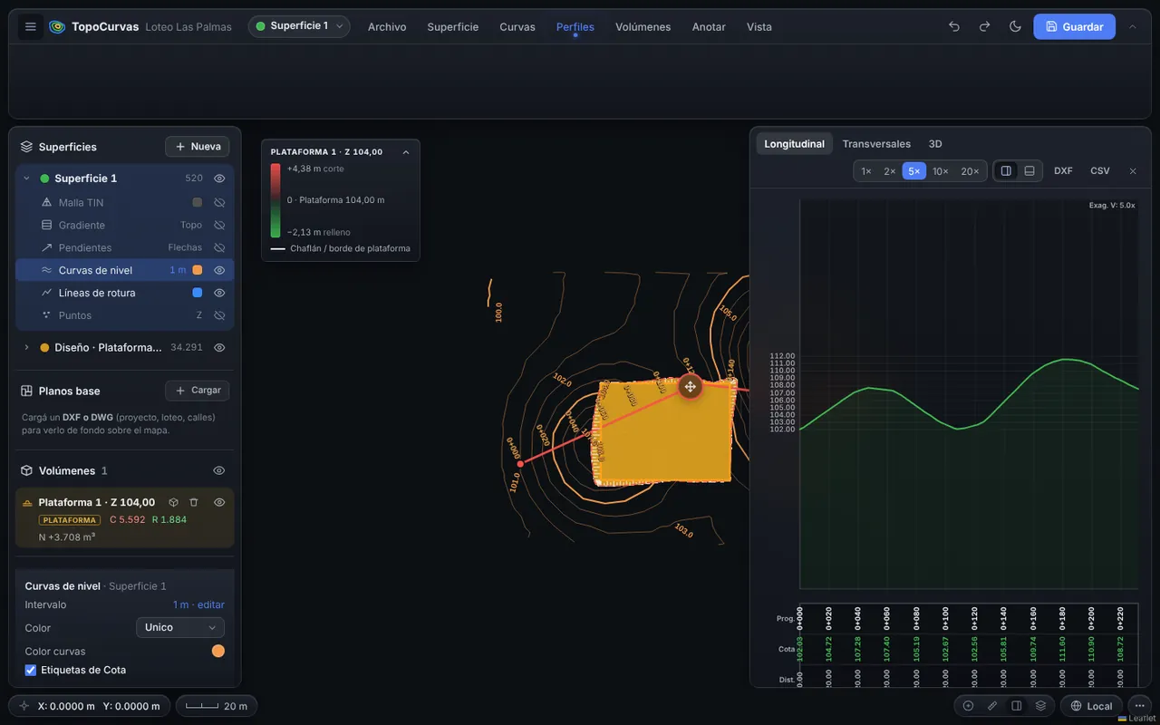
Draw the alignment on the map and the ground is interpolated from the TIN mesh. The profile and sections update as you move the alignment.
Developed by 
What it includes
Longitudinal profile with data band
Chainage, ground elevations and partial distances, with 1× to 50× vertical exaggeration.
Cross sections
At a configurable interval, with a general width and a custom width per section by dragging its ends on the map.
Alignment range
Compute sections only between two chosen chainages.
Live editing
Drag the alignment vertices and adjust profile elevations with the mouse or your finger.
Export
Scaled DXF, CSV with chainage and coordinates, and sheets with several sections per page.
How it works
- Draw the alignment by clicking on the map.
- Choose the interval and the width of the sections.
- Review the profile and sections in the panel.
- Export DXF, CSV or sheets.
FAQ
Can I add a design grade?
Yes. In the profile-based volume calculation you set a level or a design surface, drawn over each section with hatched cut and fill.
How many sections fit on a sheet?
The sheet composer picks a scale so that about twelve sections fit on an A1 sheet and orders them by columns or rows.
You may also like
Contour line generator from survey points
Upload the points file from your survey and get contour lines in seconds, on a TIN mesh you can fix by hand so the terrain looks the way it really is.
Learn more →Cut and fill volume calculator
Compare the existing ground against a level, a pad or a design surface and get cut, fill and the material to haul away or bring in, with a report ready to deliver.
Learn more →Export your survey to DXF and ready-to-deliver sheets
Before exporting you see a preview of how it will look in CAD, with the chosen sheet and plot scale, so text stays readable and does not overlap.
Learn more →Try it with your own points
It runs in your browser: no account, nothing to install.
Open the free app