
Contour line generator from survey points
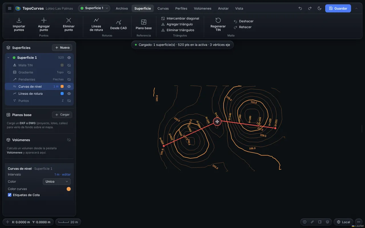
Upload the points file from your survey and get contour lines in seconds, on a TIN mesh you can fix by hand so the terrain looks the way it really is.
Developed by 
What it includes
Delaunay triangulation
High-performance TIN mesh, with diagonal flipping, added or removed triangles and new points with interpolated elevation.
Breaklines
Ridges, road edges and streams, drawn by hand or taken from a layer of your DXF.
Index and intermediate contours
Interval of your choice, index contours every 5 intervals and smoothing for a clean result.
Elevation labels
Aligned with the contour and kept from overlapping each other.
Slope map
Colors by slope class and arrows showing where water runs.
3D view
See the terrain in 3D with adjustable vertical exaggeration.
From a CAD drawing
You can also start from the contour lines or a TIN in a DXF or DWG, and generate new contours from that surface.
How it works
- Import the TXT, CSV or XYZ file and choose the columns.
- Review the mesh and add breaklines if needed.
- Pick the interval and generate the contour lines.
- Export the DXF at the plot scale you need.
FAQ
Which contour interval should I use?
It depends on scale and relief: 0.5 m or 1 m for urban sites and subdivisions, and 2 to 5 m for large or steep areas. You can try several and see the result instantly.
Can the contour lines be corrected?
Contours are generated from the TIN mesh, so you correct them by editing the mesh, the breaklines or the points, and they regenerate instantly.
You may also like
Surfaces from CAD: contour lines and TIN in DXF and DWG
Did the terrain arrive as an AutoCAD drawing? Import the DXF or DWG and TopoCurvas builds the surface from the contour lines or the 3D faces (TIN) in the drawing, so you can generate contours, profiles and volumes without surveying again.
Learn more →Longitudinal profile and cross sections
Draw the alignment on the map and the ground is interpolated from the TIN mesh. The profile and sections update as you move the alignment.
Learn more →Cut and fill volume calculator
Compare the existing ground against a level, a pad or a design surface and get cut, fill and the material to haul away or bring in, with a report ready to deliver.
Learn more →Try it with your own points
It runs in your browser: no account, nothing to install.
Open the free app